Giant Slide Plus 6-Peaks
In sticking with our "uniquely Acadia" theme, this hike offers great views of a glacially carved river valley that has wonderful cascades of water if it has been wet. It also provides great views from Parkman Mt., Bald Mt., Cedar Swamp, Penobscot, Sargent and Gilmore.
Finding the trailhead
From the Junction of route 233 and 198, drive south about 0.9 miles. The trail head should be on the left. There is a very small parking area there that has space for two or three cars. (Brown Mountain Bus will leave you off here if you ask the driver.) If there is no parking available, continue another 0.2 miles to Giant Slide Road (on the left) and park. Walk up Giant Slide Road and you will cross the Giant Slide Trail and get all of the good parts of the trail!
Details of the Hike
Type of Hike: Loop
Total Distance: about 8 miles
Vertical up/down: at least 2500 feet
Rating: Difficult/Iron Man!
The views on the Hike:
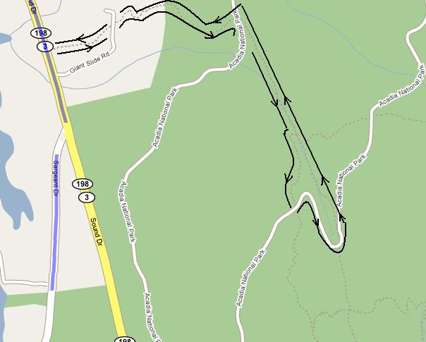
Until you reach the intersection of the Trail and Giant Slide
Road, its just a flat walk in the woods. When you reach Giant
Slide, the glacial remnants are all around you. In places, you
are going under tunnels of glacial rock remnants. If it has been
rainy, there are waterfalls and cascades everywhere. When
you reach the first signpost, bear right. (If you go straight,
there is a tunnel.) Follow along this trail until you reach a
carriage road.
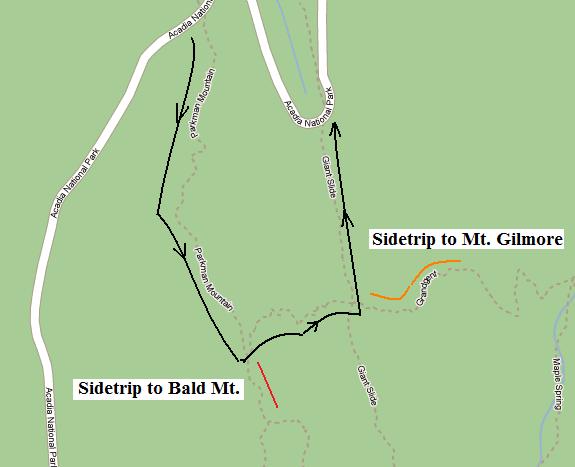
Cross the carriage road and continue to the top
of Parkman. If you look straight south you will see Bald. To
the left is Gilmore and behind Gilmore is Sargent.
Follow the sign down and up to Bald Peak. In addition to
great views of Mt. Gilmore, Sargent and Parkman, it also
opens to show Norumbega to the West and the Hadlock
ponds in front of you. Theres only one way to continue. The
map calls the trail Wildcat Valley but the sign only says To
Rte. 198 Parking Lot.
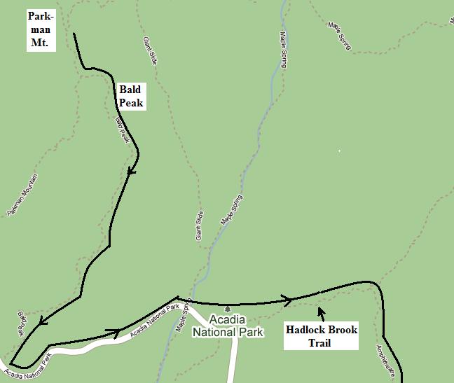
When the trail crosses the Carriage
Road, take the carriage road East. Cross one bridge passing
Maple Spring. At the second bridge overlooking a beautiful
waterfall, get on the Hadlock Brook Trail. This is a left turn
with the trail proceeding to the Northeast,
The first right off Hadlock Brook puts you on the
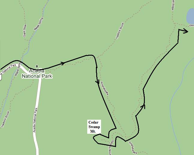
Amphitheater Trail toward Birch Spring. At Birch Spring
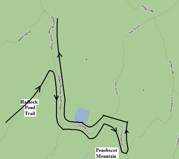
follow Sargent South Ridge less than 0.1 mi to
Cedar Swamp Peak where you get a nice view of
the Amphitheater.
Double back toward Sargent Pond and follow the trail until
the peak of Penobscot Mt. From here there are wonderful
views of Jordan Pond, the Bubbles, Pemetic and Cadillac
Mts.
Continue on next map.
Double back toward Sargent Pond and follow the North
Ridge Trail to the summit of Sargent. Enjoy the views from
Sargent
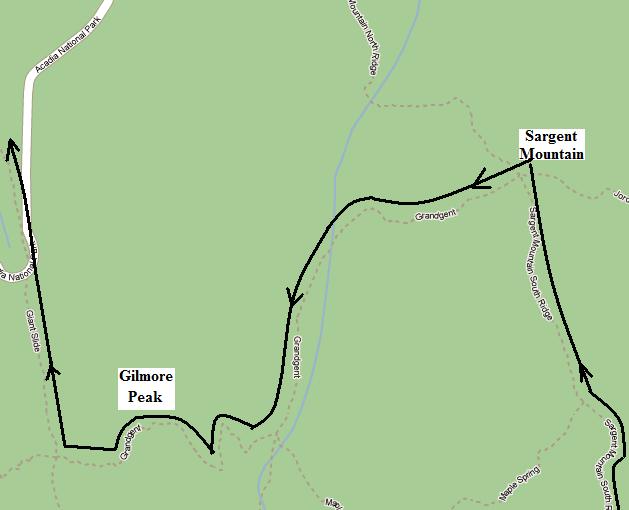
Follow Grandgent to Gilmore.
From Gilmore, continue on Grandgent until it crosses Giant
Slide. Take a right on Giant Slide and follow it back to Rte.
198. If you are using maps, this takes you to the right side
of the first map.
In Summary
In an intense and long hike, you've gotten a hearty work out and a set
of "Uniquely Acadia Views," both of the 6-peaks and the glacial valley.
On my "uniquely
Acadia scale", I rate this hike an A.